|
Misi mencari MH370 masuk hari ke-27, meliputi 223,000km persegi KUALA LUMPUR: Operasi mencari pesawat Malaysia yang hilang masuk hari ke-27 hari ini, dengan kawasan pencarian meliputi kira-kira 223,000 kilometer persegi kira-kira 1,680km di barat laut Perth, Australia.
Pusat Koordinasi Agensi Bersama (JACC) dalam kenyataan hari ini berkata sebanyak lapan pesawat dan sembilam kapal akan membantu dalam misi pencarian hari ini. "Sebuah daripada pesawat itu ditugaskan untuk menggugurkan boya penanda datum yang dilengkapi alat khas untuk mengesan lokasi pesawat itu di kawasan pencarian," menurutnya. JACC dilancarkan pada 1 April di Perth bagi menyelaraskan operasi mencari pesawat Malaysia Airlines Penerbangan MH370. Menurut kenyataan itu, keadaan cuaca hari ini dijangka cerah dengan jarak penglihatan kira-kira 10 kilometer, dan hujan sekejap-sekejap diramal berlaku di kawasan selatan Lautan Hindi.  KOMANDER Pegawai Memerintah Kapal KD Lekiu, Jamsari Tahir (belakang) melihat radar kawasan pencarian MH370 ketika kapal berkenaan berlabuh di Pangkalan Tentera Laut HMAS Stirling, Perth, Australia.
This Data Model Shows MH370 Could Not Have Flown "Accidentally" To Its Destination
None of the plane's paths can be reconciled with a geodesic, meaning the plane took multiple, intentional turns before going dark. By Conor Myhrvold Over the past two weeks, FastCoLabs has been building a Monte Carlo model to predict potential paths of MH370. I wrote about Version 1 last week and after the piece hit Reddit I added a more technical description. Now I've updated and extended the model, using information that wasn't yet available earlier. This project is also available as code: Part 1, Part 2, and Part 3, and as a full file via GithHub. Picking Up Where We Left Off We last left off with a relatively simple Markov Chain Monte Carlo (MCMC) model, trying to predict possible flight paths for the missing airliner. I used the plane's previous heading--assuming MH370 tended to along a similar direction as before, with some ability to turn--and the tendency to head to the last ping arc (8:11 am) at each time to probabilistically determine its subsequent locations. The last ping arc took into account enough distance on either side--through the standard deviation--to effectively cover an area which blanketed the other pings as well [1]. Each new location only depended on the heading of the previous step, while the ping arc probability grid which made the plane tend toward the last ping arc, remained constant. Results consistently showed, across a range of reasonable variations, that MH370 “chose” the southern arc most frequently and ended off the Australian West Coast, confirming independent Inmarsat Doppler analysis identifying a similar area of ocean nearby: 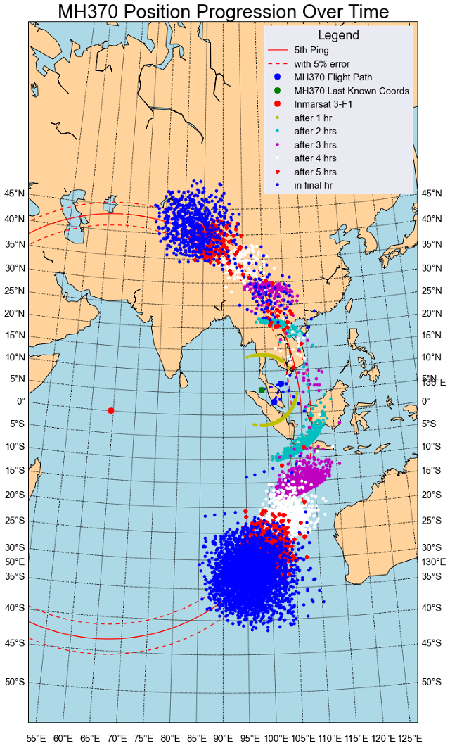 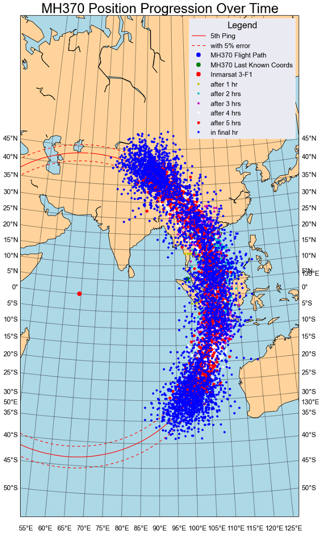 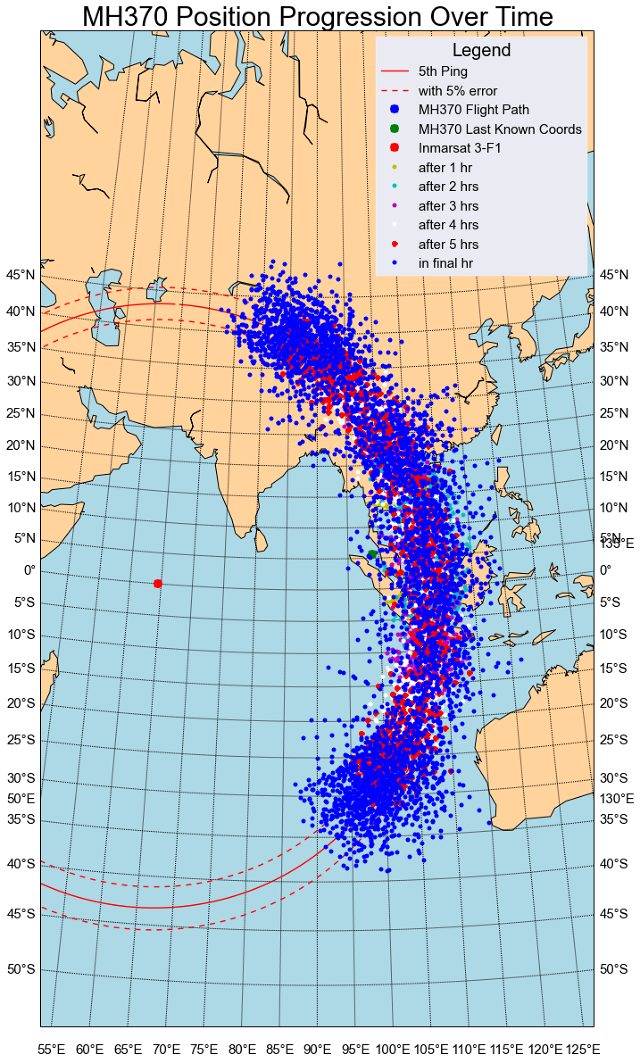 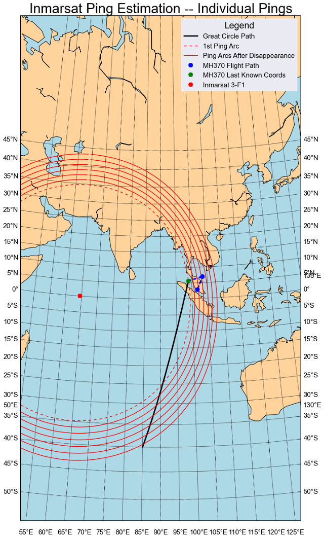 MH370 Flight Trajectory Through All Pings So, here are the results, with the realistic normal heading assumption of Version 1 along with the realistic options in Version 2 for Wrapped Cauchy [6] and Von Mises: 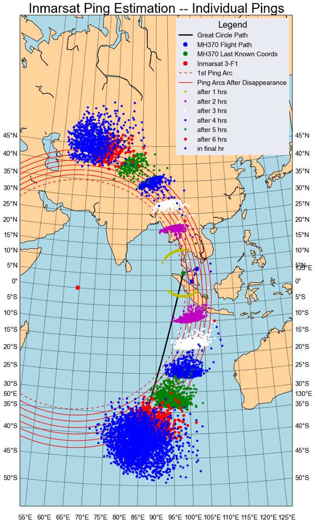 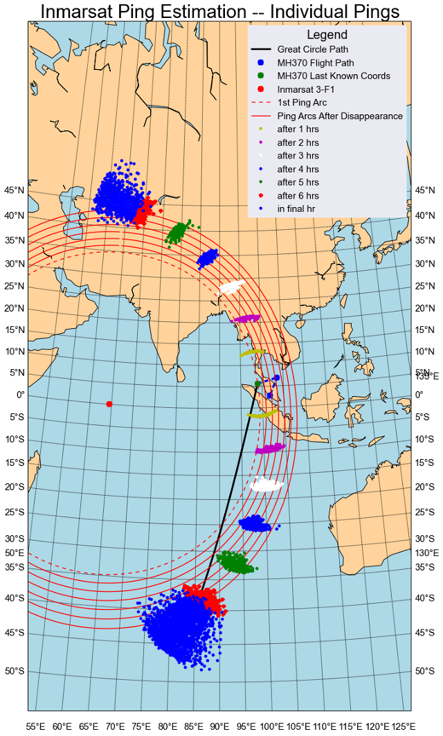 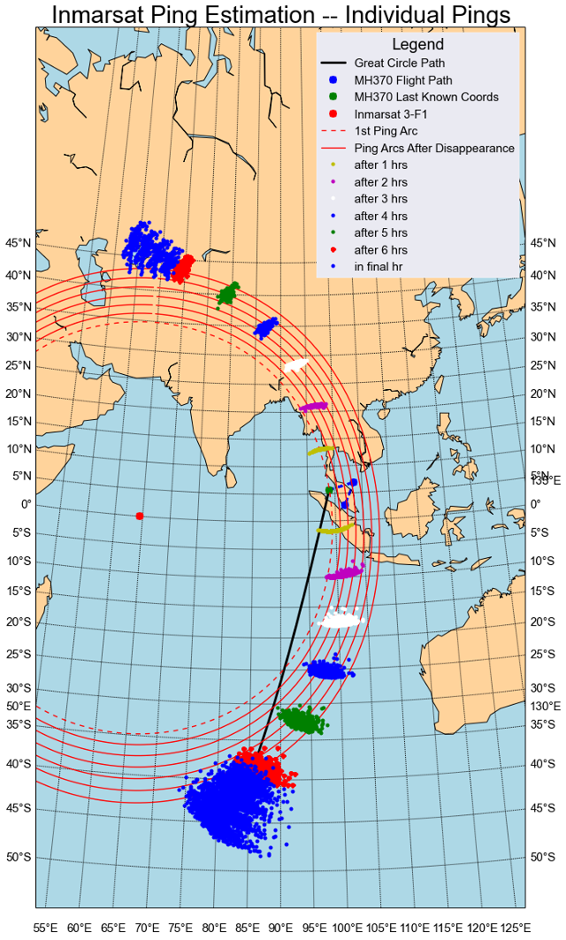 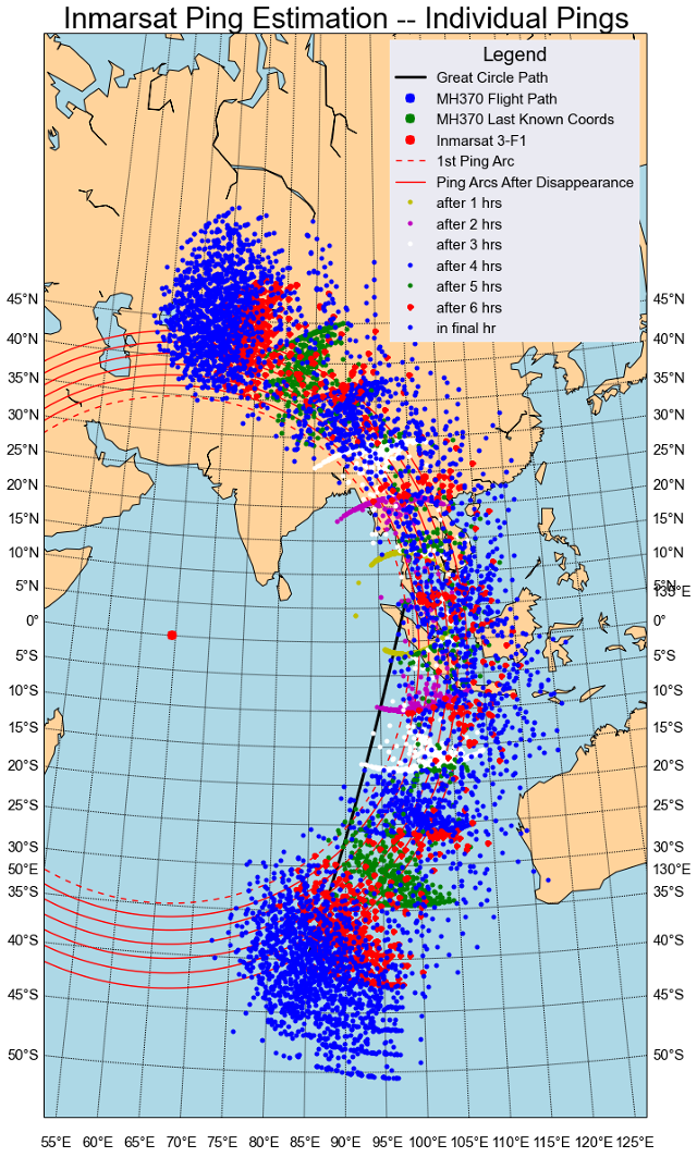 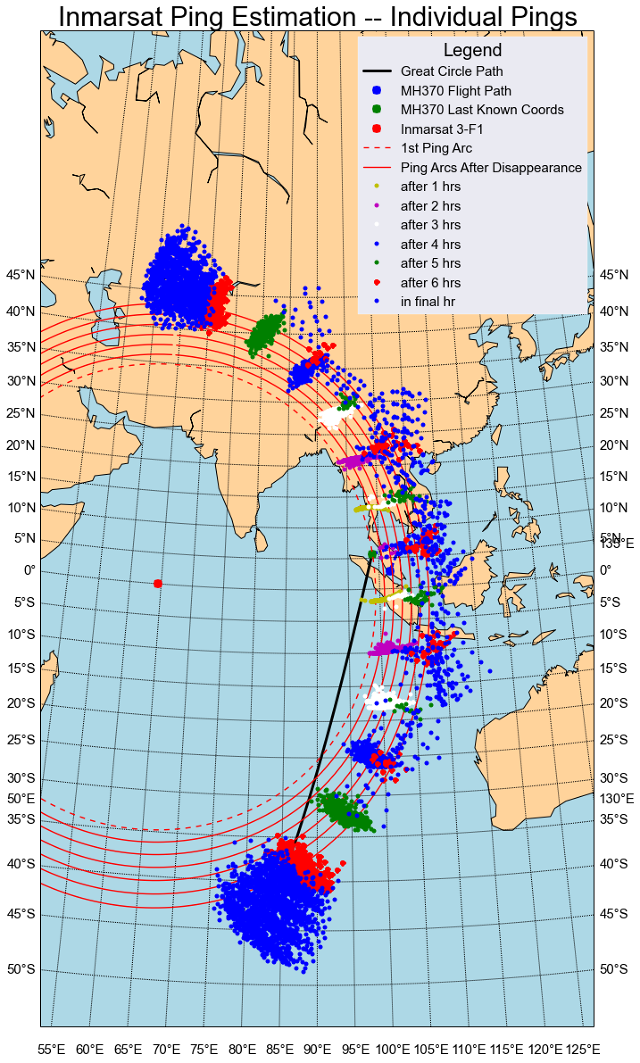 |
revolusi_30 posted on 3-4-2014 01:13 PM
Nape kenyataan asyik bercanggah je ... Patutl org cakap MaLIEsia.


RED 666 posted on 3-4-2014 01:10 PM
sekejap kata dah jumpa, sekejap kata belum jumpa, apa2pun harap akan jumpa juga dalam masa terdekat ...
ADVERTISEMENT